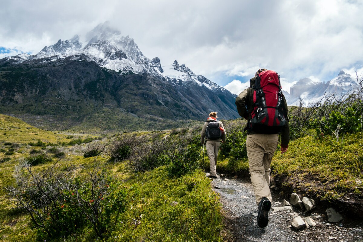
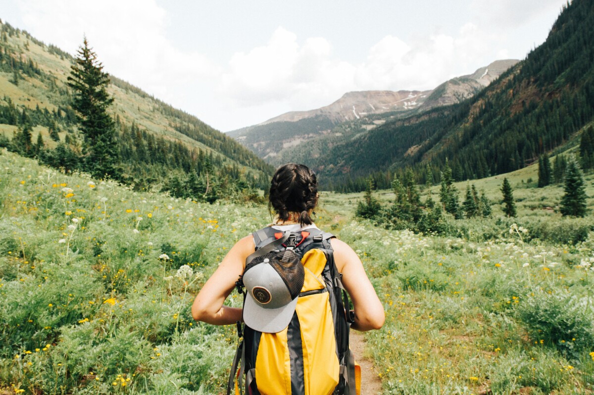
Hiking is an excellent way to keep fit and clear your mind, whether in the mountains, by the sea or in the middle of the countryside. Many applications dedicated to hiking are available on smartphones. Here is our selection to help you find your way around and accompany you on your most beautiful walks.

A few clarifications are necessary before we begin. First of all, you should know that many applications dedicated to hiking or cycling are designed above all for those who are used to reading topographical maps, who possibly know how to use a compass and who do not will not allow themselves to be destabilized by dry and unwelcoming interfaces. But other simpler apps also exist.
Finally, it’s probably a no-brainer for seasoned hikers that if you’re going hiking, remember that these apps consume a lot of energy. So remember to charge your phone to the maximum when leaving, or even bring an external battery. On this specific point, the good old paper map will always have an advantage.
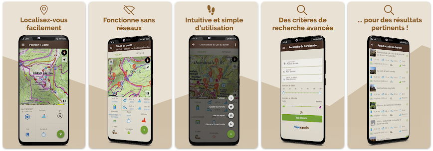
Visorando, one of the references of the hiking app
The Visorando application is one of the benchmarks for hiking. Very complete, the application supports several activities (on foot, mountain biking, skiing, horse riding, canoeing, etc.) that the user selects in advance. You then need to define the duration of the activity, its level of difficulty and whether or not you want to return to the starting point.

The application then submits a list of hikes with a series of information (number of km, elevation gain, duration). By clicking on the hike of your choice, the interface allows you to define the desired base map (IGN Topo, IGN Satellite, OpenStreetMap hiking, OpenStreetMap and OpenStreetMap cycling). Downloading the map to your phone is possible.
A tab “Details» provides a complete description of the hike, accompanied by valuable advice to avoid taking the wrong path in tricky places. Another tab «Notice» finally allows you to consult feedback from other users. In short, Visorando is both very complete and very practical.
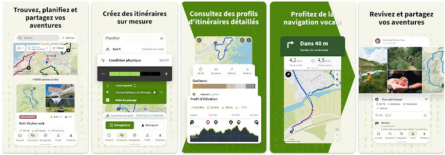
Komoot, to easily find a hike
Komoot is an easy-to-use application: indicate the activity practiced, your physical condition (the degree of difficulty, in other words), the type of hike (loop or one way) and your current location. A map then allows you to select points of interest (bridges, crossing point, chapel) from which the application will imagine the hike.

A search tab gives you the opportunity to filter the type of walk, including the essentials, natural sites, passes or refuges, to name a few. You can then save the hike or click on the “Navigation» which will guide you throughout your outing. The camera option directly available in the interface can also be practical for immortalizing a moment in one click.
Once the hike is selected, the interface shows a plethora of information about it: from the type of routes to the type of surfaces to the elevation profile. Very appreciated completeness. Only Komoot maps are accessible for free.
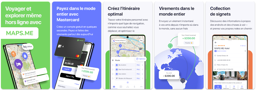
Maps.me, to view offline maps
Maps.me won’t necessarily help you find your favorite hikes, but it is very useful once you’re on the trail. Consider downloading the map corresponding to the geographic area where you plan to go and then benefit from a very detailed plan without needing to be connected to the Internet. It is a reference for offline GPS.

You can import your routes in GPX format to the app if you wish. But even without taking the time to do this, you will never be lost since, it really must be emphasized, Maps.me is very precise and even displays certain very small paths and trails. In comparison, a service like Google Maps offers much less detail once you’re out in the wilderness.
On Maps.me, there’s a very small chance that you’ll find yourself in an area where there isn’t a little dotted path appearing on the screen to reassure you and give you an idea of which direction you’re going.
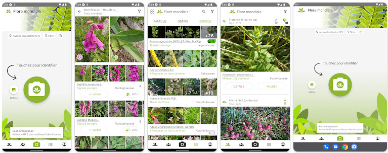
PlantNet: recognizing the flora around us
Walking around is good, but knowing exactly what you see is even better. With PlantNet, it’s possible! This application could commonly be summarized as a “Plant Shazam“. The application works like this: you take a photo of a plant, you enter it into the application, you specify the part of the plant it is (leaf, stem, bark, etc.), then all this will be compared in the PlantNet database to give you a result.

Problem: you have to be connected to the Internet, something which is rather rare when you go on certain paths.
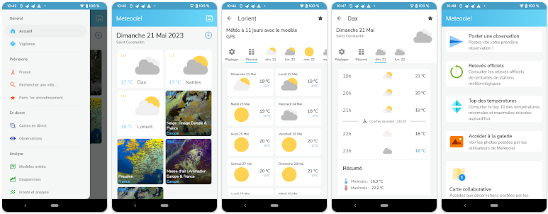
Météociel or Météo France: find out the weather before going out
Before you hit the road and embark on a hike in bad weather, it’s best to have a weather app and use it. For this, Météociel or Météo France are the best in this area if you are looking for a weather application other than the one installed by default on your smartphone.

Météociel displays a multitude of weather parameters updated every 15 minutes, with precise forecasts for more than 200 French and European cities. It also has an active community which provides its own observations of the sky, allowing you to know the weather in real time, before setting off on the trails.
Météo France is the most popular weather application, displaying weather forecasts hour by hour, during the day, at the weekend or over 7 days, for all cities in France. Actual and felt temperatures, precipitation, UV index, humidity level and vigilance map are among its many features.
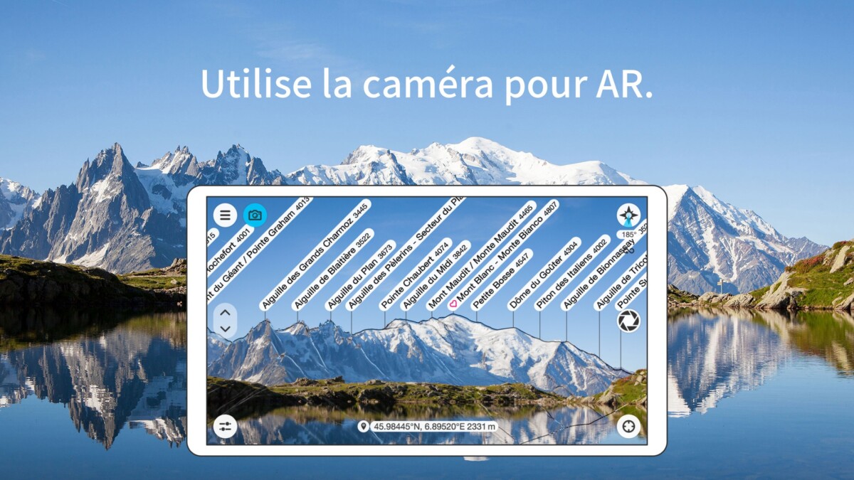
PeakFinder: for mountain hikes
If you’re planning to go hiking in the mountains, PeakFinder is the app to download. Very practical, it identifies the summits you have in front of your eyes using an augmented reality system. Simply place your smartphone, as if you wanted to take a photo, to see the names of the mountains materialize.

Informative and including a database of over a million peaks, PeakFinder provides information on every ridge, needle and other rock peaks around the world. What remains most impressive is the 360° panorama which allows you to fly through the mountains like a bird.
Thanks to its geolocation system, compass and accelerometer sensors, you can zoom in to view smaller mountains, select a point on a map, on the summit in front of your eyes and within a radius of 300 km and even in a vertex directory.

PeakFinder
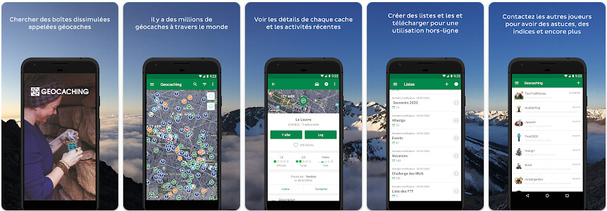
Geocaching: for fun hiking
Do you sometimes find that apart from getting some fresh air, hiking doesn’t really motivate you? Why not add a little spice to your walk by transforming it into a real treasure hunt?

The Geocaching app ingeniously combines walking, exploring, digging and solving puzzles to make your hikes more exciting. Thanks to its increasingly active community of players, you can find new routes for free, exchange items and even create your own treasure hunt.
Choose a nearby treasure to find, use the GPS to navigate to the location of the treasure and then use your brain and your sense of observation to find the object to discover. Ideal for motivating adults and children!
Paid maps for your hikes
An element to take into account for the vast majority of these applications is thatthey are almost never provided with complete and detailed maps. Some of these apps do offer free maps, but they will never be as good as IGN or Michelin maps. “Good” cards charge a fee and often require an annual subscription the price of which can vary enormously.
Roughly speaking, count on average 20 euros per year to access a good part of the IGN catalog unlimitedly and offline. This is the price of a single card and as long as you have a tablet or smartphone screen large enough, it is a very good investment.

For this price, you will have access to excellent maps, very precise with the elevation, the viewpoints, the slightest bit of trail or forest path… In short, everything you need to orient yourself correctly.
Also note that we are talking to you about IGN maps because they are references in the field, but that these applications have the good taste to offer for some hundreds of other mapping companies at very diverse prices and in different countries. other than France. It’s up to you to see which is best, but always make sure to check that you can consult them without having access to the Internet. We wouldn’t want to lose our precious readers over a careless mistake.
If you are interested, you can also find our best running and trail applications.

Author Bio
A connoisseur of the digital marketplace and a master of the written word, this 30-year-old English expert brings to the table a wealth of knowledge rooted in the sale of digital products and a passion for blogging that resonates with an audience seeking expertise and insight in the online realm.
Their insights are drawn from hands-on experience navigating the intricacies of e-commerce and content creation—leading the forefront of digital innovation and communication. Whether it’s breaking down complex marketing strategies or sharing tips on how to captivate an online audience, their work stands as a testament to a career built upon successful digital engagement and savvy business acumen.
Stay tuned to absorb compelling content from a voice that not only understands the digital landscape but also shapes its future through every blog post and digital strategy.